
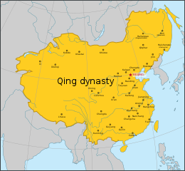
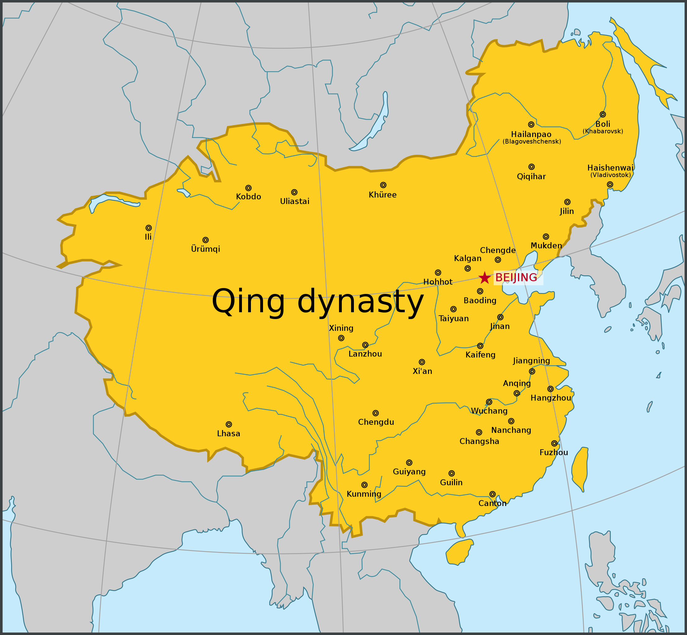
文檔:Map of Qing dynasty 18c.svg

此 SVG 檔案的 PNG 預覽的大小:649 × 600 像素。 其他分辨率:260 × 240 像素 | 519 × 480 像素 | 831 × 768 像素 | 1,108 × 1,024 像素 | 2,215 × 2,048 像素 | 834 × 771 像素。
原始文件 (SVG檔案,表面大細: 834 × 771 像素,檔案大細:201 KB)
摘要
| 簡話 |
[] |
| 日期 | |
| 來源 | 我個人以下列物件為基礎來創作: 18 century Qing China.png |
| 作者 | Samhanin |
| 其他版本 |
[]
|


授權
我,本作品的著作權持有者,決定用以下授權條款發佈本作品:
| 此檔案在創用CC CC0 1.0 通用公有領域貢獻宣告之下分發。 | |
| 在此宣告之下分發本作品者,已依據各國著作權法,在全世界放棄其對本作品所擁有的著作權及所有相關相似的法律權利,從而將本作品貢獻至公有領域。您可以複製、修改、分發和演示該作品,用於任何商業用途,所有這些都不需要請求授權。
|
檔案歷史
按到日期/時間去眵吖許時間有過嗰檔案。
| 日期/時間 | 縮圖 | 尺寸 | 用戶 | 說明 | |
|---|---|---|---|---|---|
| 眼前 | 2022年5月27日 (禮拜五) 17:14 | | 834 × 771(201 KB) | En rouge | The map width has been enlarged to include the full display of Sakhalin. As a result, the Japanese coastlines and the Philippine coastlines were extended. |
| 2020年12月26日 (禮拜六) 15:34 |  | 512 × 498(183 KB) | Nv7801 | fix font | |
| 2020年12月26日 (禮拜六) 15:33 |  | 512 × 498(180 KB) | Nv7801 | Update | |
| 2016年8月9日 (禮拜二) 05:11 |  | 790 × 768(69 KB) | Samhanin | fix | |
| 2016年8月9日 (禮拜二) 05:09 |  | 790 × 768(69 KB) | Samhanin | fix | |
| 2016年8月9日 (禮拜二) 05:07 |  | 790 × 768(70 KB) | Samhanin | User created page with UploadWizard |
檔案使用
冇頁面連結到箇隻檔案。
全域文件用途
以下其他 wiki 使用了這個檔案:
- en.wikipedia.org 嗰使用狀況
- io.wikipedia.org 嗰使用狀況
- it.wikipedia.org 嗰使用狀況
- ko.wikipedia.org 嗰使用狀況
- pa.wikipedia.org 嗰使用狀況
- pnb.wikipedia.org 嗰使用狀況
- pt.wikipedia.org 嗰使用狀況
- war.wikipedia.org 嗰使用狀況