
文檔:Map of Great Barrier Reef Demis.png
預覽嗰尺寸:535 × 599 像素。 其他分辨率:214 × 240 像素 | 429 × 480 像素 | 945 × 1,058 像素。
原始文件 (945 × 1,058 像素,檔案大細:200 KB ,MIME類型:image/png)
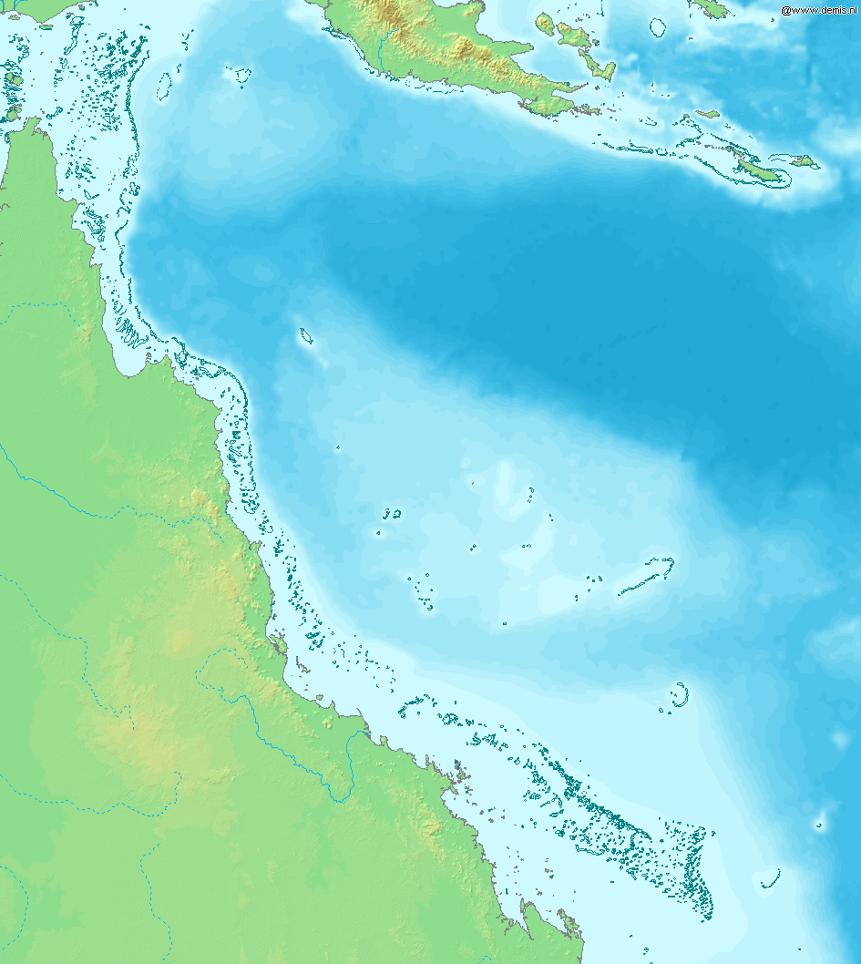
Map of Great Barrier Reef.
Bounding box West 142°, South -23°, East 155°, North -9°. Center at 16°00′00″S 148°30′00″E / 16.00000°S 148.50000°E.
This image is in the public domain because it came from the site https://www.demis.nl/products/web-map-server/examples/ and was released by the copyright holder. Permission is granted to copy, distribute and/or modify this map since it is based on free of copyright images from: www.demis.nl. See also approval email on de.wp and its clarification.
|
| This work has been released into the public domain by its copyright holder, www.demis.nl. This applies worldwide. 這可能在某些國家不合法,如果是的話: www.demis.nl授予任何人有權利使用此作品於任何用途,除受法律約束外,不受任何限制。
|
檔案歷史
按到日期/時間去眵吖許時間有過嗰檔案。
| 日期/時間 | 縮圖 | 尺寸 | 用戶 | 說明 | |
|---|---|---|---|---|---|
| 眼前 | 2006年12月20日 (禮拜三) 16:11 | | 945 × 1,058(200 KB) | Mats Halldin~commonswiki | Map of Great Barrier Reef. Bounding box West 142°, South -23°, East 155°, North -9°. Center at {{coor d|16.00000|S|148.50000|E|scale:8400000}}. {{demis-pd}} Category:Maps of Australia |
檔案使用
底下嗰1隻頁面連結到箇隻檔案:
全域文件用途
以下其他 wiki 使用了這個檔案:
- af.wikipedia.org 嗰使用狀況
- am.wikipedia.org 嗰使用狀況
- ar.wikipedia.org 嗰使用狀況
- as.wikipedia.org 嗰使用狀況
- bn.wikipedia.org 嗰使用狀況
- br.wikipedia.org 嗰使用狀況
- bs.wikipedia.org 嗰使用狀況
- ckb.wikipedia.org 嗰使用狀況
- en.wikipedia.org 嗰使用狀況
- es.wikipedia.org 嗰使用狀況
- fiu-vro.wikipedia.org 嗰使用狀況
- fo.wikipedia.org 嗰使用狀況
- fr.wikipedia.org 嗰使用狀況
- he.wikipedia.org 嗰使用狀況
- id.wikipedia.org 嗰使用狀況
- ja.wikipedia.org 嗰使用狀況
- jv.wikipedia.org 嗰使用狀況
- ka.wikipedia.org 嗰使用狀況
- kn.wikipedia.org 嗰使用狀況
- la.wikipedia.org 嗰使用狀況
- mai.wikipedia.org 嗰使用狀況
- mk.wikipedia.org 嗰使用狀況
- ml.wikipedia.org 嗰使用狀況
- mr.wikipedia.org 嗰使用狀況
- ms.wikipedia.org 嗰使用狀況
- ne.wikipedia.org 嗰使用狀況
- new.wikipedia.org 嗰使用狀況
- oc.wikipedia.org 嗰使用狀況
- pnb.wikipedia.org 嗰使用狀況
- sah.wikipedia.org 嗰使用狀況
- sh.wikipedia.org 嗰使用狀況
- sk.wikipedia.org 嗰使用狀況
- ta.wikipedia.org 嗰使用狀況
- th.wikipedia.org 嗰使用狀況
- ur.wikipedia.org 嗰使用狀況
- vep.wikipedia.org 嗰使用狀況
- xmf.wikipedia.org 嗰使用狀況
- yi.wikipedia.org 嗰使用狀況